='"loading" + data:blog.mobileClass'>
Showing posts with label storm. Show all posts

Saturday 2 November 2019

Wild night of windy weather off Cornwall.


You the weather must be poor when you see the two big stern trawlers, Wiron 6 and Wiron 5 alongside a couple of french boats dodging in the lee provided by the Isles of Scilly...


even the weather buoy south of Plymouth harbour is showing close to 40 knot winds at 6am this morning...


while wind data from the Sevenstones Lightship has only just started responding again and is now headed for 50 knots, when an area of low pressure passes over the south west, the barometric pressure decreases and the wind increases...


as the WindyTV weather animation shows, the worst is about to pass...


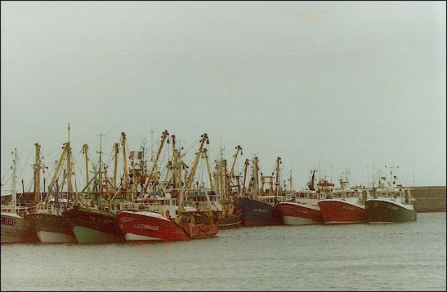
just as well with 45knot winds indicated (that's around 50mph) which is keeping all the Newlyn fleet safely tucked up in the harbour - gusts up to 60mph have been reported al over the west of Cornwall...


not so lucky are these guys, 19 Breton trawlers and crabbers all still fishing or dodging - some of whom are east side of the Lizard between Falmouth and the Dodman Point which helps to cut down rise and fall of the heavy westerly Atlantic swell...


scan95.jpg

not so many years ago, Newlyn and other Cornish ports would be full of these hardy Breton trawlermen in their then slightly smaller (18m) boats - but it seems these days that the extra 3 or 4m in length many of their boats now have makes all the difference between fishing or dodging in poor weather and having to make for a port of refuge!

Thursday 7 December 2017

#StormCaroline - "Cyclonic, becoming northwesterly, severe gale 9 to violent storm 11, occasionally hurricane force 12 at first."

This morning's shipping forecast for Fair Isle issued at 0505 December 7th 2017 as...


#StormCaroline, the first of several severe weather systems hits the north of Scotland hard this morning...


but for many, life at sea continues as this AIS map shows an abundance of marine traffic between Scotland and the Faroes including the 90m pelagic trawler, Joseph Roty...


this video giving a small sense of what it is like to fish in extreme weather when you have 90m of steel under your feet...


the latest WindyTV forecast shows a very unsettled period of weather into next week.

Saturday 10 January 2015

From gales in Cornwall to storms in Shetland


The current weather systems courtesy of EarthNull show the main protagonist - an area of intense low pressure off the top of Scotland with the wind travelling in an anti-clockwise direction giving the hurricane force south westerly to westerly winds- while, unusually away to the west of the UK deep in the North Atlantic is a small(ish) area of high pressure - a bit of a renegade in meteorological terms as it is normally a huge area of high pressure that creates the 'North Atlantic blocking system' which forces successive lows coming across from the eastern seaboard of the US to travel north east across the ocean - giving the UK its familiar weather pattern of southwesterly - westerly winds that eventually go north west - only to start the cycle all over again as the next low hits arrives on our shores...


average wind speed from the weather buoy 64406 off the top of Scotland at 0700 today...


with the corresponding wave height data...


contrasted with the wind speed from the buoy at the Sevenstones off Land's End, Cornwall... 


looking ahead to the 14th when things don't look so good either!